|
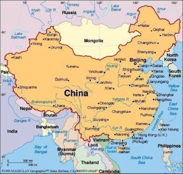
Map of China Major Cities and Rivers China has some 11 countries on its border and has border disputes with most of them. In the south the high elevations of the Himalayas make it difficult to exactly determine the national boundaries. Unlike the United States China's rivers mostly flow West to East. The main rivers are the Yellow River debouching near Beijing, the Yangzi debouching near Shanghai and the Xun debouching near Guangzhou. Lastly the Mekong River which flows mostly south into Laos. Mileage Between Chinese CitiesReturn to China Choices |
| Map of the Cities of People's Republic of China |