|
Armenia
Background:
An Armenian Apostolic Christian country, Armenia was incorporated
into
Russia in 1828 and the USSR in 1920. Armenian leaders remain
preoccupied
by the long conflict with Azerbaijan over Nagorno-Karabakh, a
primarily
Armenian-populated region, assigned to Soviet Azerbaijan in the
1920s by
Moscow. Armenia and Azerbaijan began fighting over the area in
1988; the
struggle escalated after both countries attained independence
from the Soviet
Union in 1991. By May 1994, when a cease-fire took hold,
Armenian forces held
not only Nagorno-Karabakh but also a significant
portion of Azerbaijan proper.
The economies of both sides have been hurt
by their inability to make
substantial progress toward a peaceful
resolution.
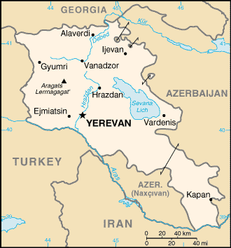
Location:
Southwestern Asia, east of Turkey.
Area: Total: 29,800 sq km water:
1,400 sq km land: 28,400 sq km.
Area - comparative: Slightly smaller
than Maryland.
Land boundaries: Total: 1,254 km border countries:
Azerbaijan-proper 566 km,
Azerbaijan-Naxcivan exclave 221 km, Georgia 164
km, Iran 35 km, Turkey 268 km.
Climate and Terrain:
Climate: Highland continental, hot summers, cold winters
Terrain: Armenian Highland with mountains; little forest land; fast
flowing
rivers; good soil in Aras River valley
Elevation
extremes: Lowest point: Debed River 400 m highest point:
Aragats
Lerrnagagat' 4,090 m
Natural resources: Small deposits of
gold, copper, molybdenum, zinc, alumina
People:
Population: 3,330,099
Ethnic groups: Armenian 93%, Azeri 3%, Russian
2%, other (mostly Yezidi Kurds) 2% (1989)
Religions: Armenian Apostolic 94%, other Christian 4%, Yezidi
(Zoroastrian/animist) 2%.
Languages: Armenian 96%, Russian 2%, other 2%.
Government:
Government type: Republic.
Capital: Yerevan.
Independence: 21
September 1991 (from Soviet Union).
Economy overview:
Under the old Soviet central planning system, Armenia had developed a
modern
industrial sector, supplying machine tools, textiles, and other
manufactured
goods to sister republics in exchange for raw materials and
energy. Since the
implosion of the USSR in December 1991, Armenia has
switched to small-scale
agriculture away from the large agro-industrial
complexes of the Soviet era. The
agricultural sector has long-term needs
for more investment and updated
technology. Armenia is a food importer,
and its mineral deposits (gold, bauxite) are small. GDP - composition by
sector: Agriculture: 29% industry: 32% services:
39%.
Statistics:
Telephones - main lines in use: 568,000 .
Telephones - mobile
cellular: 25,000.
Radio broadcast stations: AM 9, FM 6.
Radios: 850,000.
Television broadcast
stations: 3.
Televisions: 825,000.
Internet users: 30,000.
Railways: Total: 852 .
Highways: Total: 11,300 km paved: 10,500
km. unpaved: 800
Airports - with unpaved runways: 7.
Return to Visiting Locations
|