|
Aruba
Background:
Discovered and claimed for Spain in 1499, Aruba was acquired by the
Dutch
in 1636. The island's economy has been dominated by three
main
industries. A 19th century gold rush was followed by prosperity
brought on by
the opening in 1924 of an oil refinery. The last decades of
the 20th century
saw a boom in the tourism industry. Aruba seceded from
the Netherlands Antilles
in 1986 and became a separate, autonomous member
of the Kingdom of the
Netherlands. Movement toward full independence was
halted at Aruba's request in
1990.
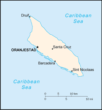
Location:
Caribbean, island in the Caribbean Sea, north of Venezuela.
Area: Total:
193 sq km water: 0 sq km land: 193 sq km.
Area - comparative: Slightly
larger than Washington, DC.
Coastline: 68.5 km.
Climate and Terrain:
Climate: Tropical marine; little seasonal temperature variation.
Terrain: flat with a few hills; scant vegetation.
Elevation
extremes: Lowest point: Caribbean Sea 0 m highest point: Mount
Jamanota
188 m.
Natural resources: NEGL; white sandy beaches.
Geography -
note: a flat, river less island renowned for its white sand
beaches; its
tropical climate is moderated by constant trade winds from the
Atlantic
Ocean; the temperature is almost constant at about 27 degrees Celsius
(81
degrees Fahrenheit).
People:
Population: 70,441.
Ethnic groups: mixed white/Caribbean Amerindian 80%.
Religions: Roman Catholic 82%, Protestant 8%, Hindu, Muslim, Confucian,
Jewish.
Languages: Dutch (official), Papiamento (a Spanish, Portuguese,
Dutch, English
dialect), English (widely spoken), Spanish.
Government:
Dependency status: Part of the Kingdom of the Netherlands; full autonomy
in
internal affairs obtained in 1986 upon separation from the
Netherlands
Antilles; Dutch Government responsible for defense and
foreign affairs.
Government type: parliamentary democracy.
Capital: Oranjestad.
Economy overview:
Tourism is the mainstay of the small, open Aruban economy,
with offshore
banking and oil refining and storage also important. The rapid
growth of
the tourism sector over the last decade has resulted in a
substantial
expansion of other activities. Construction has boomed, with
hotel capacity
five times the 1985 level. In addition, the reopening of
the country's oil
refinery in 1993, a major source of employment and
foreign exchange earnings,
has further spurred growth. Aruba's small
labor force and low unemployment rate
have led to a large number of
unfilled job vacancies, despite sharp rises in
wage rates in recent
years. The government's goal of balancing the budget
within two years
will hamper expenditures, as will the decline in stopover
tourist
arrivals following the 11 September terrorist attacks.
Labor force - by
occupation: Most employment is in wholesale and retail trade
and repair,
followed by hotels and restaurants; oil refining.
Industries: Tourism,
transshipment facilities, oil refining.
Statistics:
Telephones - main lines in use: 33,.
Telephones - mobile
cellular: 3,402.
Radio broadcast stations: AM 4, FM 6.
Radios: 50,000.
Television broadcast stations: 1.
Televisions: 20,000.
Internet
users: 4,000.
Highways: Total: 800 km paved: 513 km note: most coastal
roads are paved,
while unpaved roads serve large tracts of the interior
(1995) unpaved: 287 km
Waterways: none
Airports: 1.
Return to Visiting Locations
|
