|
Bouvet Island
Background:
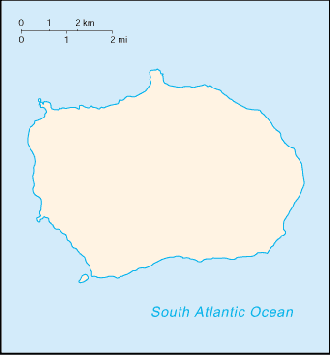
This uninhabited volcanic island is almost entirely covered by glaciers and is
difficult to approach. A French naval officer after whom the island was named
discovered it in 1739. No claim was made until 1825, when the British flag was
raised. In 1928, the UK waived its claim in favor of Norway, which had occupied
the island the previous year. In 1971, Bouvet Island and the adjacent
territorial waters were designated a nature reserve. Since 1977, Norway has run
an automated meteorological station on the island.
Location:
Island in the South Atlantic Ocean, southwest of the Cape of Good
Hope (South Africa)
Area: Total: 58.5 sq km.
Area - comparative: About 0.3 times the size of Washington, DC
Coastline: 29.6 km
Maritime claims: Territorial sea: 4 NM
Climate and Terrain:
Climate: Antarctic.
Terrain: Volcanic; coast is mostly inaccessible.
Elevation extremes: Lowest point: South Atlantic Ocean 0 m, highest point:
Olav Peak 935 m.
Natural resources: None.
Land use: Arable land: 0%.
Geography - note: Covered by glacial ice; declared a nature reserve.
People:
Population: Uninhabited. We have had 4 request from here in March 2005.
Government:
Dependency status: Territory of Norway; administered by the Polar Department of
the Ministry of Justice and Police from Oslo.
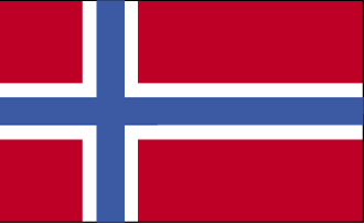
Flag description: The flag of Norway is used.
Economy overview:
No economic activity; declared a nature reserve
Statistics:
Internet country code: .bv
Communications - note: Automatic meteorological station.
Ports and harbors: None; offshore anchorage only.
Return to Visiting Locations
|