|
El Salvador
Background:
El Salvador achieved independence from Spain in 1821 and from the Central
American Federation in 1839. A 12-year civil war, which cost about 75,000
lives, was brought to a close in 1992 when the government and leftist rebels
signed a treaty that provided for military and political reforms.
|

Climate and Terrain:
Climate: Tropical; rainy season (May to October); dry season (November to
April); tropical on coast; temperate in uplands.
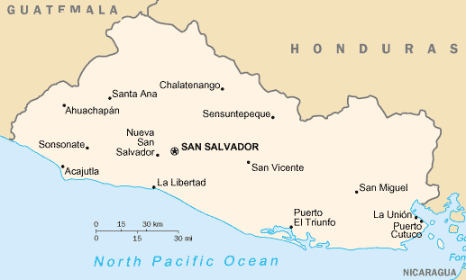
Terrain: Mostly mountains with narrow coastal belt and central plateau.
Geography - note: smallest Central American country and only one without a
coastline on Caribbean Sea
Economy overview:
In recent years, this Central American economy has been suffering from a weak
tax collection system, factory closings, the aftermaths of Hurricane Mitch of
1998 and the devastating earthquakes of early 2001, and weak world coffee
prices. On the bright side, inflation has fallen to single digit levels, and
total exports have grown substantially. The trade deficit has been offset by
annual remittances of almost $2 billion from Salvadorans living abroad and by
external aid. The US dollar is now the legal tender. Because competitor
countries have fluctuating exchange rates, El Salvador must face the challenge
of raising productivity and lowering costs.
|
|