|
Umpqua Lighthouse State Park
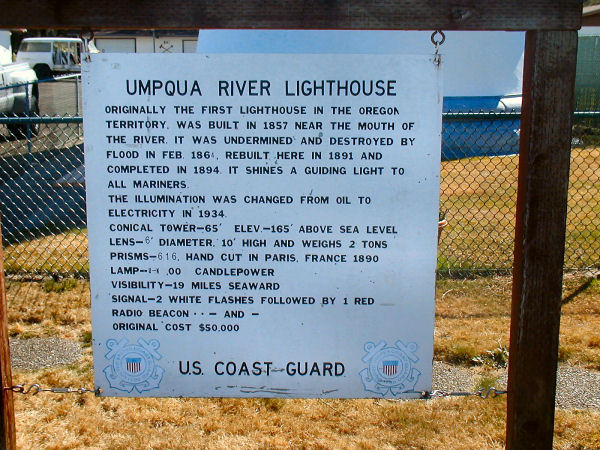
7. Lighthouse Facts The Umpqua River is formed by the confluence of the North Umpqua and South Umpqua rivers, both of which rise in the Cascades, approximately 6 miles (10 km) northwest of Roseburg. In modern terminology, the "Umpqua Valley" is sometimes taken to refer to the populated lower reaches of the South Umpqua south of Roseburg, along the route of Interstate 5. The North Umpqua rises from snowmelt and is considered one of the premier summer steelhead streams in the West. The combined river flows generally northwest through the Coast Ranges in a serpentine course past Umpqua and Elkton. At Elkton it turns to flow west past Scottsburg. It enters Winchester Bay on the Pacific at Reedsport. It receives the Smith River from the north near its estuary on Winchester Bay. The Umpqua River Lighthouse protects the mouth of the river. ⇦ Back to Page 6 On to Page 8 ⇨Return to Umpqua Lighthouse |
| Umpqua Lighthouse Facts |